Group: Members
Posts: 32
Member No.: 9385
Joined: April 15, 2015
Any one know of..if they even exist of maps for the lower French , Wolseley Bay Area? Going to try for a few days for musky a few maps to look over wouldn’t hurt lol
Group: Members
Posts: 1374
Member No.: 11890
Joined: May 16, 2016
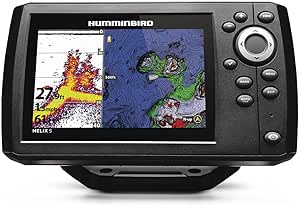
The 3 times that I've been to that area, I've used the Navionics Chartviewer as a starting point. You can't set up waypoints like on your boat's sonar, but it works very well for scoping out locations for depth, rocks, weeds, points and drop-offs. https://webapp.navionics.com/#boating@10&key=ihdyGdrvhN
Group: Members
Posts: 678
Member No.: 18006
Joined: January 23, 2020
X2 on Navionics maps (on cell phones). On mine I show depth charts for most of the areas mentioned, but not sure if waypoints can be used. It is the way to go since the main charts services (Lakemaster/Navionics) do not offer the lower French River mapping, at least past Dokis. What a fantastic area to fish and explore though.
My brother and I are going camping in the French River PP, launching from Wolseley bay at the end of the month. Last time on the French River, I was lucky to land a 54" female Muskie. (with a successful live release) Who knows, might catch her again....lol. Hopefully by months end the water temps have dropped a good 20C+ degrees so the Walleye tie will put on the feed bag.
Group: Members
Posts: 32
Member No.: 9385
Joined: April 15, 2015
OK thanks for the help guys..I'll be there the same time..looking for the 54 incher for sure..hopefully I'll finally get my 1st French river fish.good luck out there
Group: Newbies
Posts: 24
Member No.: 12460
Joined: October 30, 2016
since your launching at wolseley bay, stop in at wolseley lodge and buy a map off of Harold.
Have him point out the Twins. Which is really the only major shoal that is in the middle of a channel that I have come across. Respect all shore lines and islands and youll be fine.
Ask him to show the common routes as well.
Map is 25$ and its waterproof.
Well worth the money for me as I mark everything on this map weeds, shoals and of course my honey holes
Fishing Lake Nipissing
Fishing forum for Lake Nipissing & Area. Fishing for walleye/pickerel, muskie, pike, bass, perch, crappie and more. Local Fishing Reports, Current Ice Conditions, Fishing Tips, Tactics, Discussions & More. Northern Ontario Fishing at it's Best!
Lake Nipissing Outdoors - Fishing Forum : Fishing Tips, Current Conditions, Fishing Reports & more! Fishing Lake Nipissing & Area