Group: Members
Posts: 256
Member No.: 3723
Joined: February 24, 2013
Ok. So one of the most asked questions on any fishing forum I have read is "where can I go to catch fish?"
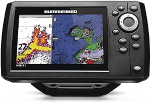
Personally, I hate this question, especially with the amount of technology available today. More people than not today carry a smartphone and there is a great app called Navionics. Yes it will cost you $17 to purchase it, but consider it part of your fishing gear.
You can look at most well traveled lakes and find all the contouring you need, pin locations you might like to fish and use the GPS function to get you to your spots.
Try it out. I bet you'll catch fish where you never thought you would before and you won't have to ask anyone!
Group: Members
Posts: 39
Member No.: 10400
Joined: January 07, 2016
I couldn't agree more , I am a Navionics fan. Its amazing to really see great structure and accurate to the foot or less. I am however guilty of still posing the question as I hear the whole lake may have fish I'm not sure about early ice and was thinking about starting at the east end of the lake next week as our accommodations are that way, but see a lot more shoals, sunken islands. ect at the south end.. So my question still is How is the east end off Sunset park or would you suggest the south? Pardon the question, Lakebeliever
Group: Members
Posts: 117
Member No.: 5636
Joined: January 12, 2014
I agree! Navionics is one of my most important tools. I find half the fun is researching seasonal habits, marking my own spots, and reaping the rewards (or not haha.) Very satisfying. I use the android app and it works great. Tip: find fish, drop pin, take screenshot Make a folder and store for quick reference.
Group: Members
Posts: 58
Member No.: 925
Joined: November 30, 2011
So it been a few years since Navionics has been available. So how accurate is the map? When it says 20ft is it? I know some lakes are better then others. How about Nipissing? Thanks
Group: Members
Posts: 288
Member No.: 16638
Joined: December 30, 2018
I find it gives you a good general idea. Water levels change and popular lakes are more accurate. I've researched humps and other structure on navionics before a trip that were no where to be found when actually on the lake. Still a great tool none the less.
Group: Members
Posts: 58
Member No.: 925
Joined: November 30, 2011
Thanks. That's what I've found. Simcoe is well mapped but less popular lakes not so much. Might be a good thing to some degree because everyone knows where to fish on Simcoe- there's no secret spots! Haven't fished Nipissing since Navionics has been available.
A lot of folks don't need the mapping in winter because outfitters decide where the huts go but for guys with there own gear and interested in exploring, the maps can be helpful.
Fishing Lake Nipissing
Fishing forum for Lake Nipissing & Area. Fishing for walleye/pickerel, muskie, pike, bass, perch, crappie and more. Local Fishing Reports, Current Ice Conditions, Fishing Tips, Tactics, Discussions & More. Northern Ontario Fishing at it's Best!
Lake Nipissing Outdoors - Fishing Forum : Fishing Tips, Current Conditions, Fishing Reports & more! Fishing Lake Nipissing & Area