For those that are new to GPS charts you may like to get a book like "The Weekend Navigator" Or try these sites
http://www.charts.gc.ca/charts-cartes/upda...isajour-eng.asphttp://www.boatsafe.com/nauticalknowhow/charts.htmhttp://www.nauticalcharts.noaa.gov/mcd/updates/LNM_NM.html1. Keep in mind that your GPS Data is paper chart data enhanced and digitized.
2. They may only update charts info every 10 yrs or so. Unless critical (Garmin, Lowrance or any other GPS have to get buy the data from whomever supply's it in the appropriate country).
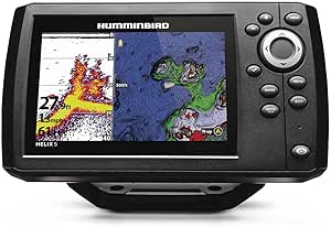
3. What you see on paper and on your GPS may be as much as twelve yrs diff in date (the present lake depths will not be on your GPS data yet so be alert and use your depth sounder) I carry paper charts and pencil in depth updates.
4. Most good GPS's should get you to an accuracy of 10-30ft.
I hope this helps the newbies and should give you a working knowledge, the rest is practise, practise, trial and error.
Good luck
Patrick



 Fishing gps, Iphone